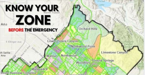
A new evacuation zone map has been released to help residents understand their evacuation zone in the event of an emergency.
Following the Silverado Fire in October 2020, in which nearly 90,000 Irvine residents were evacuated from their homes, the Irvine Police Department's Office of Emergency Management sought to expand the evacuation zone map beyond just those communities threatened by wildfires. The City's new evacuation zone map now includes all-hazard evacuation zones throughout the entire City, which are easily broken down by neighborhood location. The map also features descriptions of each evacuation type.
Residents are encouraged to review the map and become familiar with their zone now, prior to an emergency. For more information regarding emergency management, visit cityofirvine.org/em.